Interstate Contracting and Restoration Request a Free Quote

Emergency
Response &
Insurance
Support

Watch Our Services in Action
Drone emergency response collage

Rapid Assessment. Clear Documentation. Informed Decisions.

Emergency Response & Insurance Claim Support

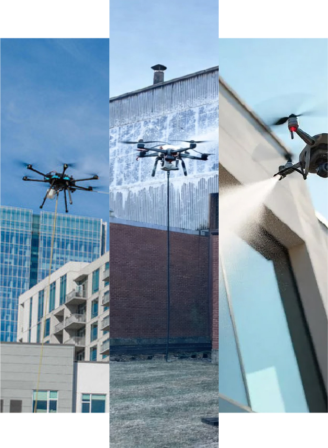
Interstate Drone Services provides fast, reliable drone-based assessment and documentation services for property owners, insurance carriers, and construction teams following damage events.

Our drone systems allow us to safely access and document affected areas quickly - often within hours - providing clear visibility of site conditions without delay.

Immediate Visibility

Rapid Damage Assessment

Following events such as storms, high winds, water intrusion, or structural impact, we deploy quickly to capture high-resolution aerial imagery and video of affected structures. Our ability to reach elevated and hazardous areas without lifts or scaffolding significantly accelerates the assessment process.
01

Assess the extent of damage

Comprehensive aerial coverage reveals the full scope of a damage event from angles traditional inspection cannot reach.

02

Identify compromised areas

Pinpoint specific locations of structural or surface damage with precision imagery delivered within hours.

03

Prioritize stabilization needs

Determine what requires immediate attention so mitigation efforts start in the right place.

04

Begin planning without delay

Skip the wait for traditional access equipment - aerial data is available faster, letting decisions happen sooner.

When Fast, Accurate Information Is Critical

Typical Events We Respond To

We provide rapid response and documentation for a wide range of events. In any situation where conditions need to be evaluated quickly and safely, drone-based assessment provides immediate value.

  • Severe storms and high wind events
  • Fire damage and post-event condition assessments
  • Hail damage and impact-related facade issues
  • Ice damming and winter-related damage
  • Roof leaks and water intrusion
  • Construction-related incidents and site damage
Drone emergency inspection sketch

Supporting the Claims Process

Insurance Claim Documentation

Accurate documentation is essential when working through an insurance claim. This information helps streamline communication between property owners, adjusters, and contractors - reducing delays and improving clarity throughout the process.

01

High-Resolution Imagery & Video

Detailed visual records of damage conditions captured from multiple angles and elevations.

02

Organized Visual Records for Claim Submission

Structured, clearly labeled deliverables formatted for easy review and distribution to all parties.

03

Before-and-After Documentation

Comparative documentation when applicable to validate scope and extent of loss.

04

Supporting Data for Scope Validation

Reduces delays and improves clarity throughout the entire claims process.

Identifying What's Not Visible to the Eye

Thermal Imaging Capabilities

In addition to visual inspections, we utilize thermal imaging technology to detect conditions that may not be immediately visible - combining thermal data with visual documentation for a more complete picture.

  • Moisture intrusion behind walls or facade systems
  • Roof leaks and trapped water detection
  • Insulation deficiencies and gaps
  • Areas of heat loss or air infiltration
Thermal Imaging ScanRecommended: thermal imaging showing roof, facade, or moisture pattern
Thermal / Visual ComparisonSide-by-side thermal and visual condition image

More Than Documentation - Actionable Insight

A Contractor's Perspective

As part of Interstate Contracting & Restoration, our team brings real-world construction and restoration experience to every project. We don't just capture images - we understand what we're looking at.

  • Recognize critical vs. cosmetic damage immediately
  • Assist in identifying likely repair scopes
  • Provide practical insight for next steps
  • Support coordination with engineers and consultants
Team / Expert Image Contractor reviewing drone footage on tablet at job site

Fast, Structured Response When You Need It Most

How It Works

Immediate Deployment

We mobilize quickly to assess the site and capture initial conditions - often within hours of your call.

Aerial Imaging & Thermal Scanning

Drone flights document visible damage and collect thermal data where needed for a complete picture.

Data Organization & Delivery

All imagery and findings are delivered in a clear, organized format for easy review and distribution.

Ongoing Support

Follow-up documentation throughout the claims and repair process, including progress tracking and final verification.

Supporting All Stakeholders in the Claims Process

Who This Is For

Property Owners & Managers

Gain immediate clarity on damage extent and next steps without waiting for traditional access methods.

Engineers & Consultants

Access reliable aerial and thermal data for structural assessment and professional reporting.

Insurance Carriers & Adjusters

Receive accurate, unbiased documentation to support claim evaluation and reduce back-and-forth.

Contractors & Restoration Teams

Use detailed visuals to develop accurate scopes and coordinate efficient, informed repairs.

In an emergency, speed and accuracy are everything. The ability to quickly assess, document, and understand damage conditions leads to faster decisions, smoother claims, and more efficient recovery.

Get in Touch

Need Emergency Response?

Our team responds quickly. Request your free quote and we'll assess your structure and recommend the right solution.
Request a Free Quote 908-756-8200