Interstate Contracting and Restoration Request a Free Quote

Mapping,
Surveying
& Data Capture

Watch Our Services in Action

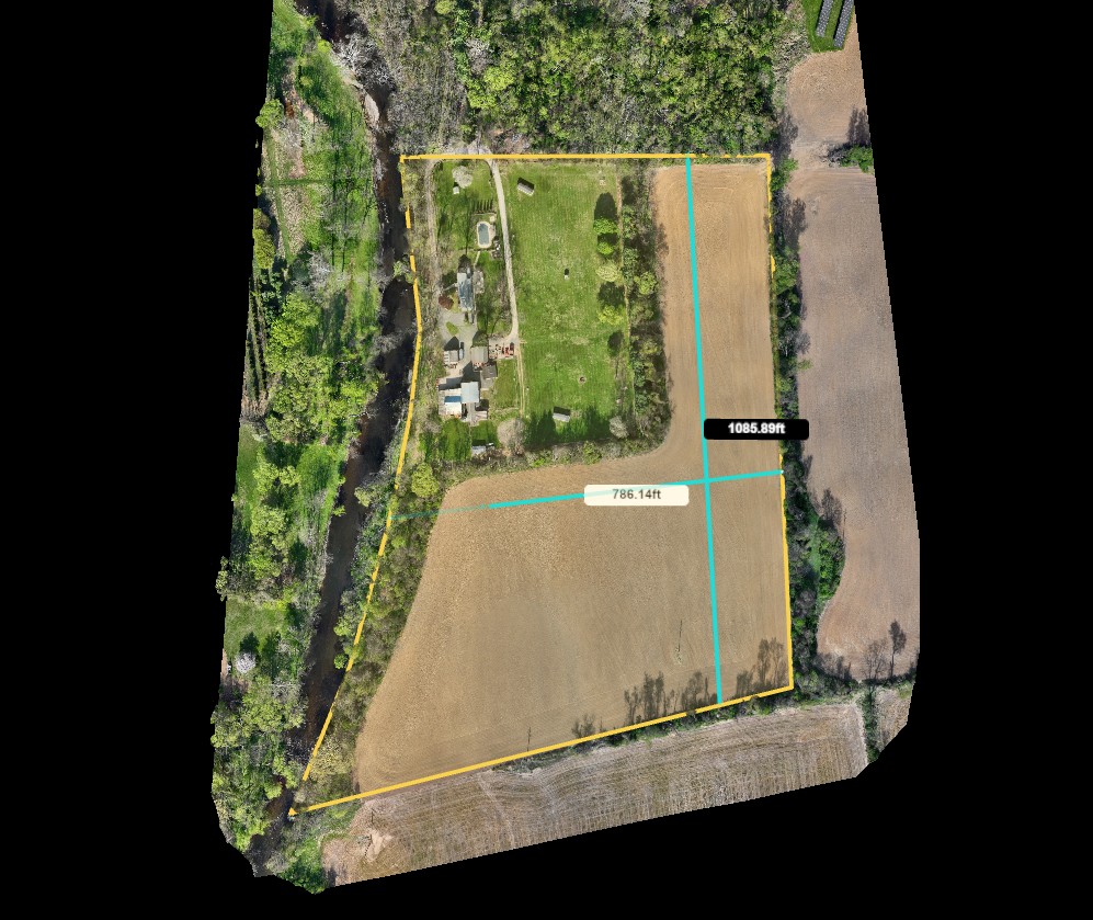
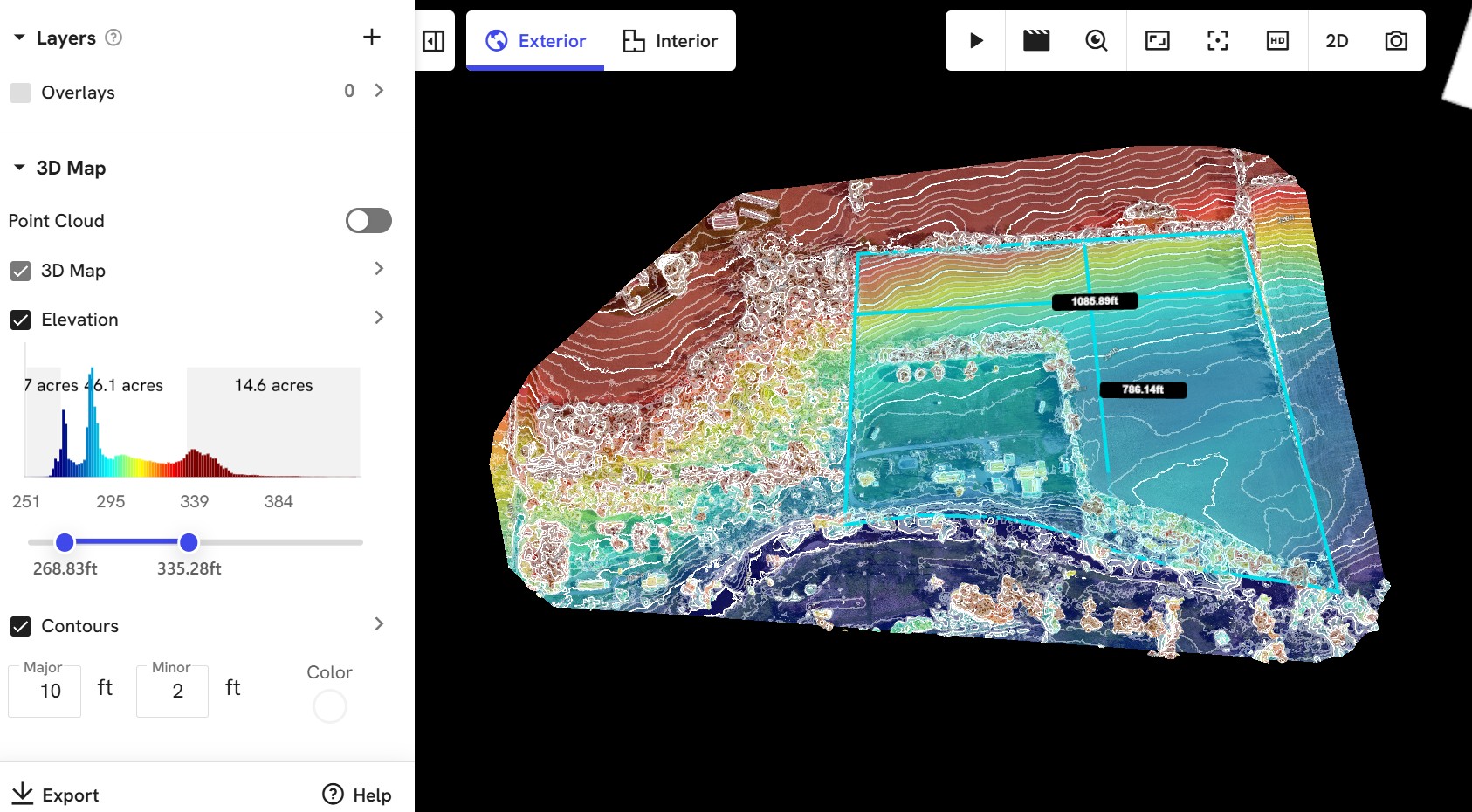
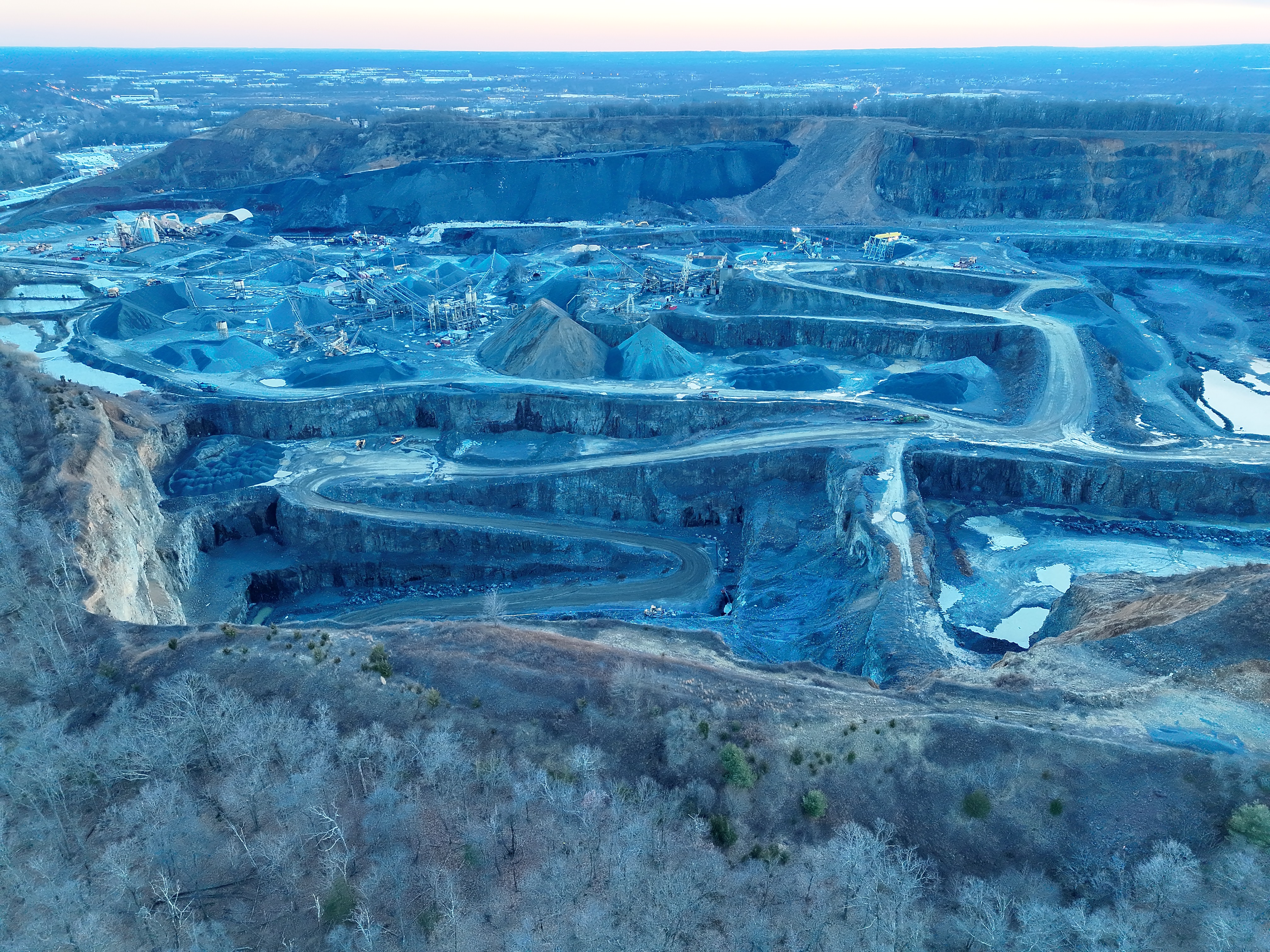
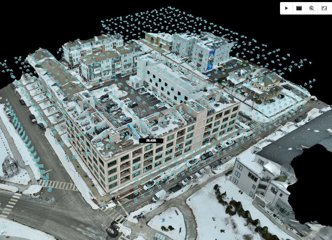
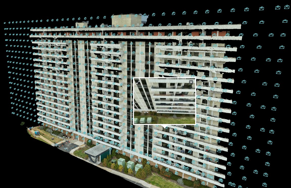
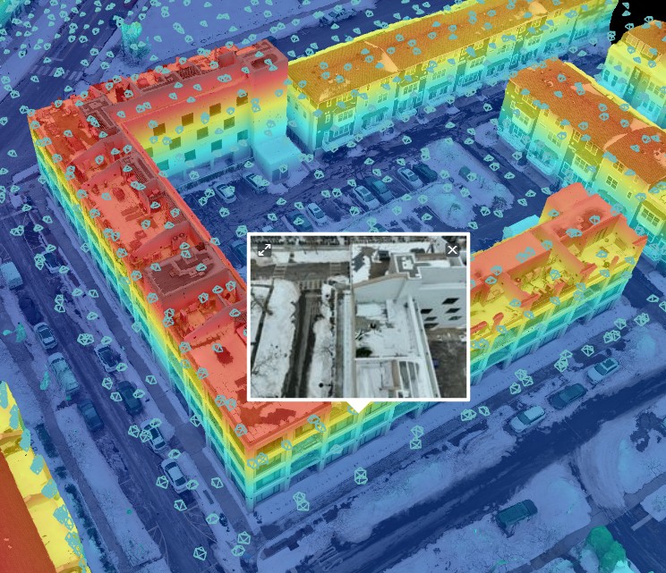
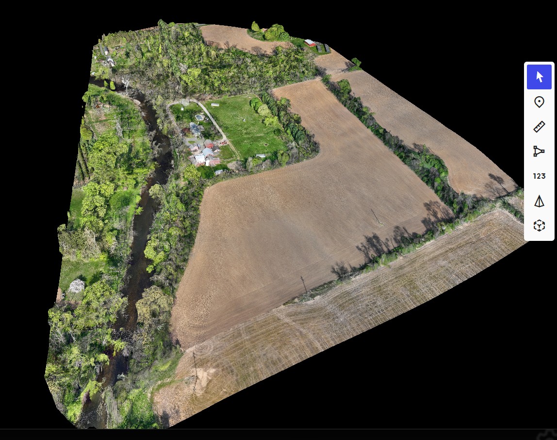
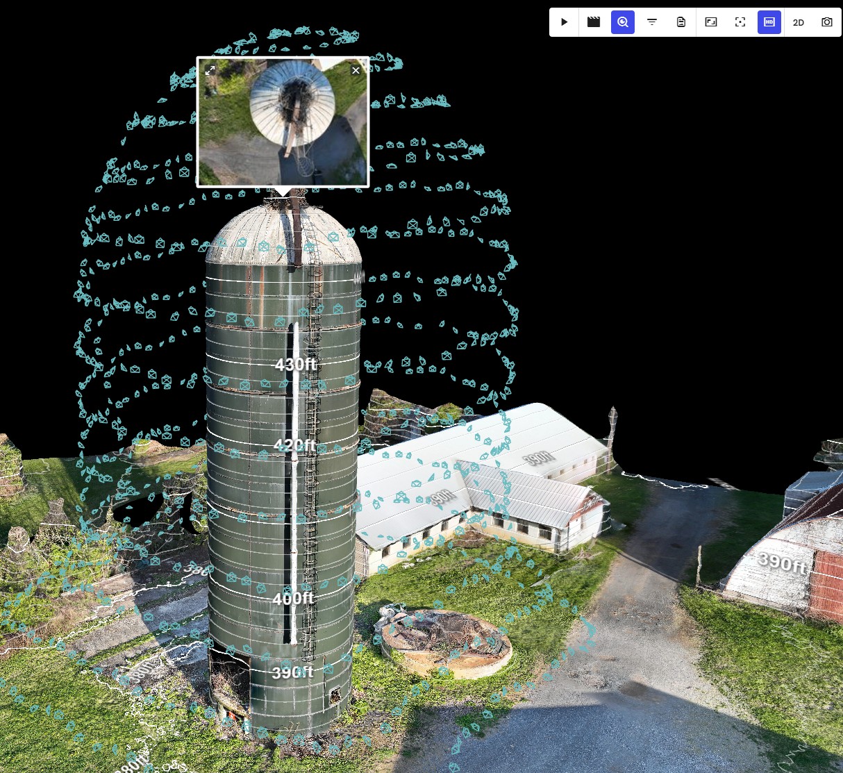
Accurate Site Data for Smarter Planning

Interstate Drone Services delivers advanced aerial mapping and data capture solutions - providing actionable, high-resolution site data for construction, engineering, and property management.

6+ Core Data Services | 360° Full-Site Coverage | GIS Ready Deliverables Request a Data Capture Quote
Drone mapping active construction site with data capture overlay

Smarter Insights. Safer Access.

Comprehensive Data Capture

Our mapping and surveying services go beyond imagery - we deliver structured data that can be used for measurement, analysis, documentation, and long-term tracking. Using advanced drone systems and processing software, we capture:

High-resolution aerial imagery of entire sites

Georeferenced site data for GIS and engineering use

Elevation and terrain models for planning and grading

Detailed surface conditions for maintenance and documentation

Data-Driven Solutions for Every Phase of a Project

Core Services

We provide a full range of mapping and data capture services covering every stage - from initial planning through long-term asset management.
01

Orthomosaic Mapping

High-resolution, georeferenced aerial maps providing accurate, measurable representations of entire sites for planning and documentation.

02

3D Modeling & Digital Twins

Detailed 3D models of sites and structures for visualization, planning, BIM integration, and long-term documentation.

03

Stockpile Volume Calculations

Accurate measurement of material volumes for inventory tracking, billing verification, and project management reporting.

04

Cut & Fill Analysis

Evaluate earthwork quantities to support grading plans, cost estimation, and site balancing with reliable aerial data.

05

3D Modeling & Digital Twins

Capture elevation data and terrain models to assist with site planning, engineering design, and drainage analysis.

06

Progress Tracking & Monitoring

Document changes over time with repeatable data capture for comparison, reporting, and stakeholder updates.

Spot-Free Results at Elevation

Water Runoff & Drainage Analysis

Using the topographic data generated through drone mapping, we analyze how water flows across a property or construction site - identifying problems before they cause long-term damage.

By evaluating elevation and grading, we can:

  • Identify drainage patterns and flow direction across the site
  • Locate low areas where water may collect or pond
  • Detect grading issues that may lead to water intrusion or erosion
  • Support planning for drainage improvements and site corrections

Especially Valuable For

  • Parking lots & paved surfaces
  • Building perimeters & foundations
  • Construction sites during grading
  • Recurring drainage issues
Drone mapping terrain and drainage analysis view

Precision, Consistency, and Reliable Data

Our Approach

Every project follows a structured four-step process to ensure accurate, consistent, and immediately usable data deliverables.
01

Site Planning & Control Setup

We review project requirements and establish flight plans and control points where required to ensure maximum accuracy.

02

Data Capture

Drone flights are executed using structured flight paths to capture consistent, high-quality data across the entire site or structure.

03

Data Processing

Captured data is processed into usable formats including orthomosaics, 3D models, elevation datasets, and volume calculations.

04

Delivery & Integration

Final data is delivered in organized formats compatible with industry-standard software used by engineers, surveyors, and project teams.

Supporting Planning, Maintenance & Asset Management

Who This Is For

Developers & Property Owners

Gain accurate site data for planning, design, and long-term asset management decisions.

Engineers & Surveyors

Access reliable datasets to support design, analysis, and professional reporting requirements.

General Contractors & CMs

Track site progress, manage materials, and improve coordination across trades and phases.

Facility & Property Managers

Document conditions of parking lots, roofs, and building exteriors for maintenance planning.

Excavation & Sitework Contractors

Utilize accurate volume calculations and grading data for efficient, cost-effective operations.

Municipalities & Infrastructure Teams

Document and manage public works, roads, utilities, and infrastructure assets with aerial data.

Accurate data is the foundation of every successful project. By capturing detailed, reliable site and structure information - including how water moves across a property - drone-based mapping allows teams to plan better, maintain assets more effectively, and make informed decisions at every stage.

Faster, Safer, and More Efficient

Why Drone-Based Mapping

Traditional surveying and documentation methods can be time-consuming and limited in scope. Drone-based mapping delivers a faster, safer, and more comprehensive alternative.

Rapid Data CollectionCapture large areas quickly without extensive field time, crews, or ground equipment.

High-Resolution AccuracyGenerate detailed datasets suitable for measurement, analysis, documentation, and reporting.

Improved Site SafetyReduce the need for personnel to navigate active, hazardous, or difficult terrain.

Repeatable ResultsCapture consistent data over time for accurate comparisons, tracking, and long-term reporting.

Drone mapping surface profile and elevation data

Mapped, Modeled, and Measured

Data Capture Gallery

Mapping, Surveying & Data Capture
Large site drone mapping overview 3D drone model of commercial building Detailed facade data model Color-coded mapping output Orthomosaic mapping model Silo inspection mapping model

Get in Touch

Ready to Capture Your Site?

From a single orthomosaic to full multi-phase documentation - our team delivers the data you need, in the format you use.
Request a Free Quote 908-756-8200